The UK Centre for Seabed Mapping (UK CSM) has announced the undertaking of a seabed mapping survey – CSM2026.
The four-week survey, which will be carried out by the group of over 30 public sector organisations making up the UK CSM, will utilise survey technology deployed from the Research Vessel Cefas Endeavour.
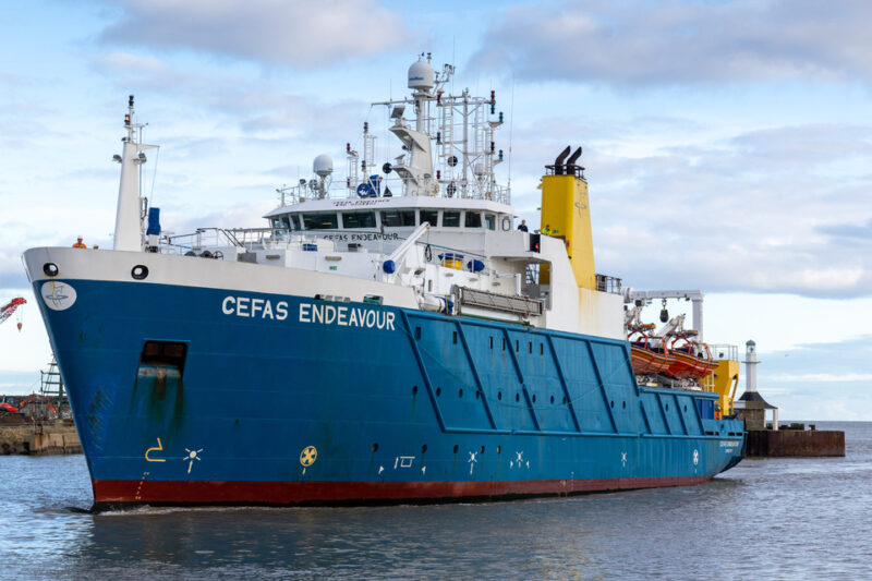
A team of 26 scientists from the maritime research sector will collect vital hydrographic, geological and environmental data when they set sail from Lowestoft on 20 April, exploring and mapping the seabed along the UK’s south-west coastline.
Convening a number of government agencies, the survey represents an unprecedented level of collaboration within the maritime sector. Each will bring their own skills and capabilities into one single survey, with the team aiming to secure data to deliver the UK government’s commitments and make advancements in the mapping of the country’s seabed, as well as provide a better understanding of how it is both understood and managed.
In total, 11 UK CSM member organisations are involved, including:
- Maritime and Coastguard Agency (MCA)
- UK Hydrographic Office (UKHO)
- British Geological Survey (BGS)
- Centre for Environment, Fisheries and Aquaculture Science (Cefas)
- Department for Environment, Food & Rural Affairs (Defra)
- The Crown Estate
- Historic England
- Joint Nature Conservation Committee (JNCC)
- Agri-Food and Biosciences Institute, Northern Ireland (AFBI)
- Natural England
- Royal Navy
During the survey, onboard scientists will be given the opportunity to work with experts from other public sector organisations, share skills and source key seabed mapping data that will be used to support a number of applications, including offshore energy and infrastructure, marine ecosystem science, safety at sea, marine policy, and defence.
The survey is scheduled to begin on 20 April and run until 19 May. It will consist of two survey legs, starting in Lowestoft, Suffolk and ending in Falmouth, Cornwall. All organisations are supporting the planning of alternative sites to maximise the opportunity.
Marine Minister Emma Hardy said:The UK is at the forefront of marine protection with a comprehensive network of 374 Marine Protected Areas, protecting more than 38% of our waters.
This survey is an excellent example of our work in partnership to improve our understanding of our maritime estate, providing data to deliver our commitments and make advances in how our seabed is mapped, understood and managed.